Recreational Signage Excursions
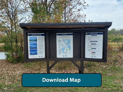
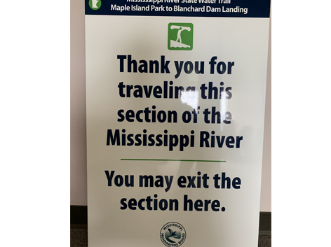
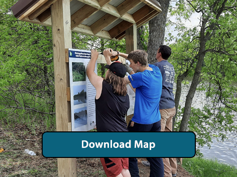
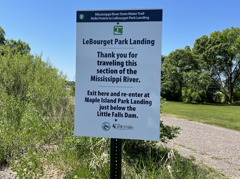
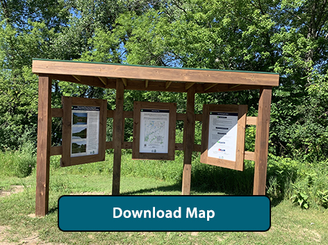
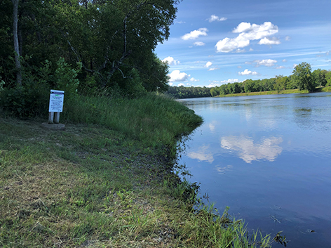
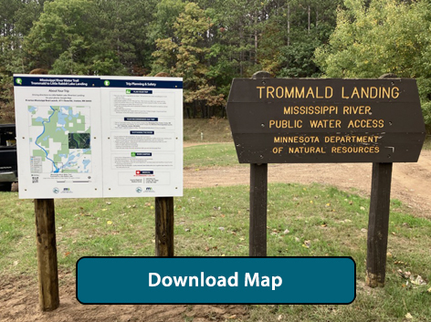
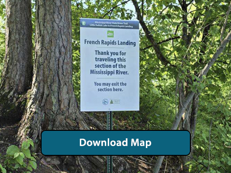
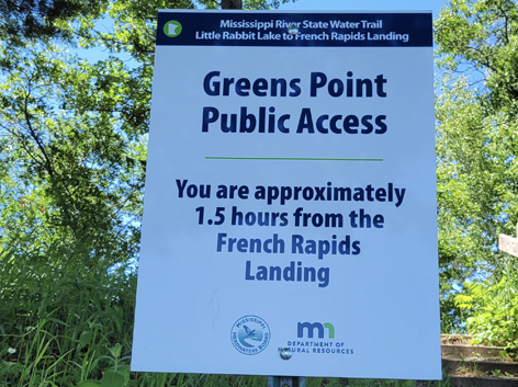
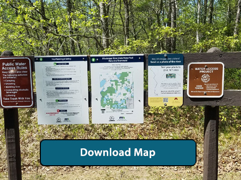
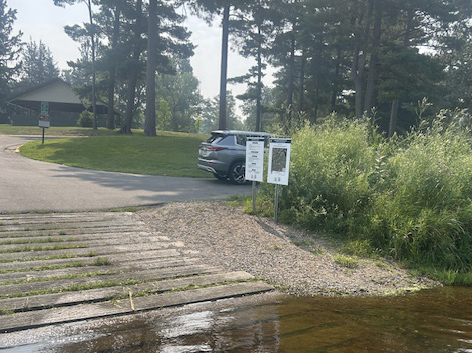
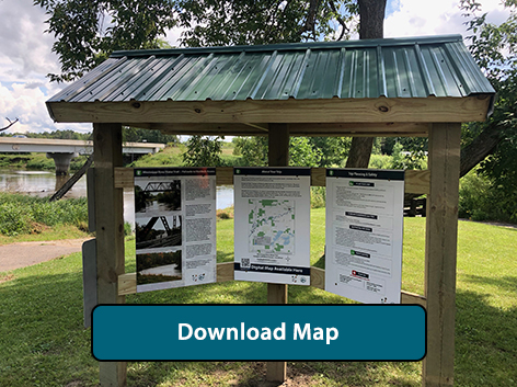
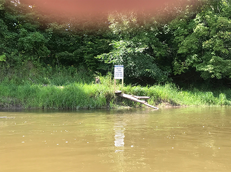
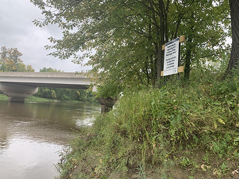
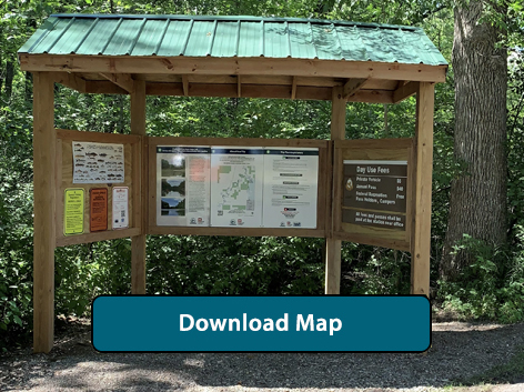
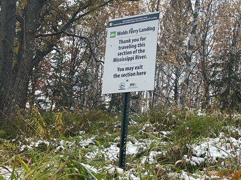
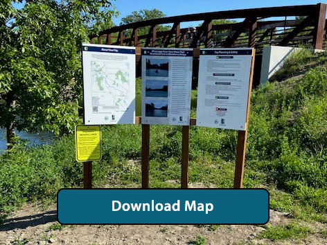
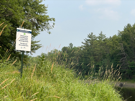
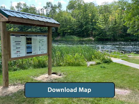
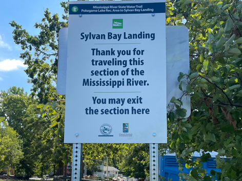
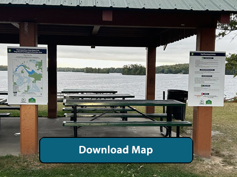
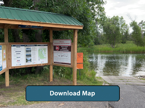
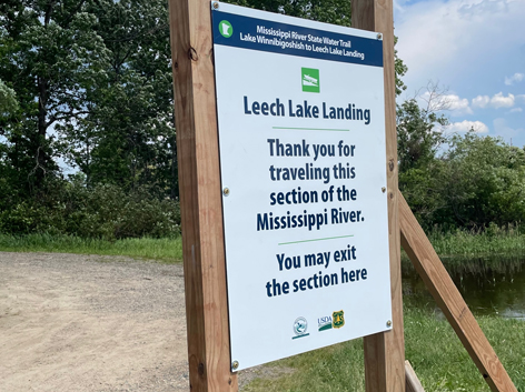
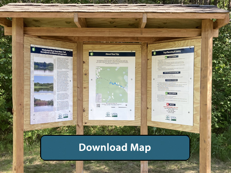
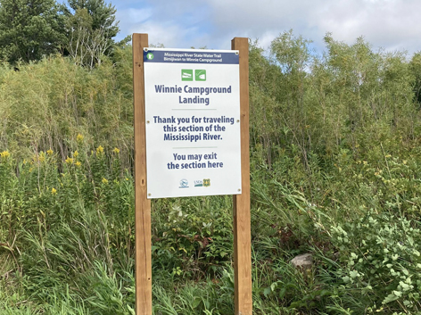
In 2019, the MHB received a grant from Enbridge and worked with Aitkin county to produce recreational signage on the Mississippi River. It was determined that many people want to recreate and take a short 3 to 5 hour trip on the Mississippi River, but lack the knowledge of where an access is located and where they can exit the River further downstream. The MHB decided that a defined trailhead kiosk with a map of where to enter and exit the Miss. River at a local park or public area would eliminate some of the fear of starting the journey. There was also an exit sign produced so that paddlers knew exactly where to exit the Mississippi once they got close a downstream landing. A QR code was developed so that smartphones could scan and download a digital map and track their journey in real time as they navigate downstream. Once the signs were produced, other counties wanted to participate and recreational signage is being developed in certain locations across the Mississippi Headwaters Board counties.
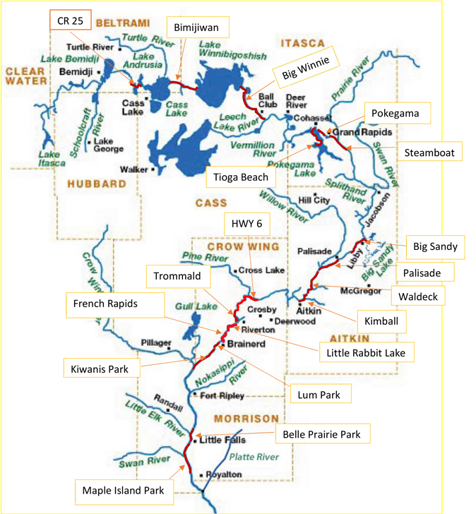
Regional View of Signed Mississippi River Excursions
(click on red stretches for a detailed map)
Morrison County
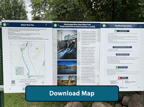
Maple Island Park to Blanchard Dam excursion- Download Map (approximate paddle time: 3 hours)
Driving Directions to Maple Island Park: https://goo.gl/maps/nBmmUCi1k7PCzSFTA
Driving Directions to Blanchard Dam: https://goo.gl/maps/GxaymZkMN2iYCdgE9
Belle Prairie Park to LeBourget Park excursion- Download Map (approximate paddle time: 1.5 hours)
Driving Directions to Belle Prairie Park: https://goo.gl/maps/LtWeHGPQKHVCbKqU7
Driving Directions to Le Bourget Park: https://goo.gl/maps/zRgiSAU74EwZyNd77
Crow Wing
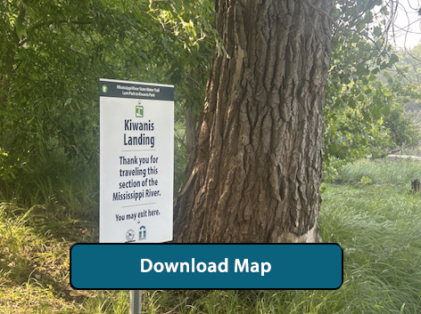
Kiwanis Park to Crow Wing State Park Excursion - Download Map (approximate Paddle Time: 3.5 Hours)
Driving Directions to Kiwanis Park Landing: https://maps.app.goo.gl/bN9KPVURJRUoYiUT8
Driving Direction to Crow Wing State Park Landing: https://maps.app.goo.gl/u6v1MUfbyyAs9kPK9
Trommald to Little Rabbit Lake Excursion - Download Map (approximate paddle time: 2.5 hours)
Driving Directions to Trommald: https://maps.app.goo.gl/k1VvuT2AfvnrcL1n7
Driving Direction to Little Rabbit Lake: https://maps.app.goo.gl/bVR9kKYGsUME4p3p8
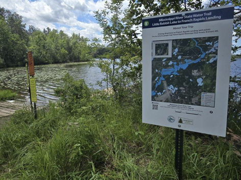
Little Rabbit Lake to French Rapids Excursion - Download Map (Approximate Paddle Time: 2 hrs. 45 minutes)
Driving Directions to Little Rabbit Lake: https://maps.app.goo.gl/9SfTYXhVWzetAd3N9
Driving Direction to French Rapids: https://maps.app.goo.gl/fNNTEjPYjrhjUE5A8
Trommald to Little Rabbit Lake Excursion - Download Map (approximate paddle time: 2.5 hours)
Driving Directions to Trommald: https://maps.app.goo.gl/k1VvuT2AfvnrcL1n7
Driving Direction to Little Rabbit Lake: https://maps.app.goo.gl/bVR9kKYGsUME4p3p8
HWY 6 to Trommald Landing Excursion - Download Map (approximate paddle time: 3 hours 45 minutes)
Driving Directions to HWY 6: Google Map Hwy 6 Water Access Minnesota 6, Crosby, MN.
Driving Directions to Trommald river access: Google Map Black Bear Lake Public Boat Launch (This isn’t the landing, so continue West on the road to the Mississippi river and you will end at the correct public water access).
Lum Park to Kiwanis Park Excursion - Download Map (approximate paddle time: 2 hours)
Driving Directions to Lum Park: Google Map Lum Park Boat Ramp.
Driving Directions to Kiwanis Park: Google Map Kiwanis Park.
 s
s
Aitkin County
Palisade to Waldeck Landing excursion - Download Map (approximate paddle time: 4 hours)
Driving Directions to Palisade: https://goo.gl/maps/Fd66fVKfqwUpWs3U8
Driving Directions to Waldeck: https://goo.gl/maps/Rrx9QvV5D8Z1MfPU7
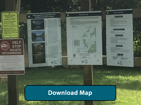
Waldeck to Kimball excursion - Download Map (approximate paddle time: 3.5 hours)
Driving Directions to Waldeck: https://goo.gl/maps/Rrx9QvV5D8Z1MfPU7
Driving Directions to Kimball: https://goo.gl/maps/BFXSnrVatdFqU9rA9
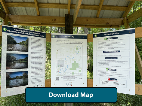
Kimball to Aitkin County Campground excursion - Download Map (approximate paddle time: 2.5 hours)
Driving Directions to Kimball: https://goo.gl/maps/BFXSnrVatdFqU9rA9
Driving Directions to Aitkin County Campground: https://goo.gl/maps/BGBRtCUzxqEMdVfz9
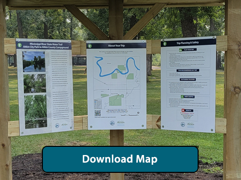
Aitkin City Park to County Campground excursion - Download Map (approximate paddle time: 2 hours)
Driving Directions to Aitkin City Park: https://goo.gl/maps/FQN9jBNjR6FU95yy8
Driving Directions to Aitkin County Campground: https://goo.gl/maps/BGBRtCUzxqEMdVfz9
Big Sandy Lake Rec. Area to Wold's Ferry Landing excursion - Download Map (approximate paddle time: 4.5 hours)
Driving Directions to Big Sandy Lake Rec. Area: https://goo.gl/maps/88cbP2eJRGQSUo937
Driving Directions to Wold's Ferry Landing: https://goo.gl/maps/JYX2FZkY5kJJDJAE7
Itasca County
Steamboat Park to Blackberry Bridge excursion - Download Map (approximate paddle time: 2.5 hours)
Driving Directions to Steamboat Park: https://goo.gl/maps/rHNiubPUTLb6phii8
Driving Directions to Blackberry Bridge: https://goo.gl/maps/dTmK1n2cYGmJX9oKA
Pokegama Lake Rec. Area to Sylvan Bay Landing excursion - Download Map (approximate paddle time: 1.25 hours)
Driving Directions to Pokegama Lake Rec. Area: https://goo.gl/maps/3uNp4beJ7yCLD26D8
Driving Directions to Sylvan Bay Landing: https://goo.gl/maps/VcVBe6tegGLvmJXL8
Tioga Beach to Pokegama Dam excursion - Download Map (approximate paddle time: 2 hours 15 minutes)
Driving Directions to Tioga Beach: Google Map Tioga Beach.
Driving Directions to Pokegama Dam: Google Map Pokegama Dam Public Water Access.
 >
>
Cass County
Lake Winnibigoshish to Leech Lake Landing excursion - Download Map (approximate paddle time: 7.5 hours)
Driving Directions to Big Winnie Dam: https://goo.gl/maps/QVDpDPoDzoUKfY237
Driving Directions to Leech Lake River Landing: https://goo.gl/maps/n1jPPkgz2PHpHTdq6
Beltrami County
Bimijiwan Recreation Area to Winnie Campround excursion - Download Map (approximate paddle time: 4 hours)
Driving Directions to Bimijiwan Rec Area: https://goo.gl/maps/bzqTAjsBizpyCRhb6
Driving Directions to Winnie Campground: https://goo.gl/maps/8Pyr5v765uMGVqhY8
CR 25 to Andrusia Lake Landing Excursion - Download Map (approximate paddle time: 4 hours)
Driving Directions to CR 25: https://maps.app.goo.gl/3bALAjtjrHNeXLnV6
Driving Direction to Lake Andrusia Landing: https://maps.app.goo.gl/bCmgMr2m9CCNPkxf7